Condition:New
Type:Logic ICs
Model Number:HG-UV98
Professional APRS dual stage console!
The handset itself has dual-mode Bluetooth built-in. The optional external Bluetooth can be plugged into the PC and can be used with the handset's built-in Bluetooth, wireless connection, wireless settings or PC communication.
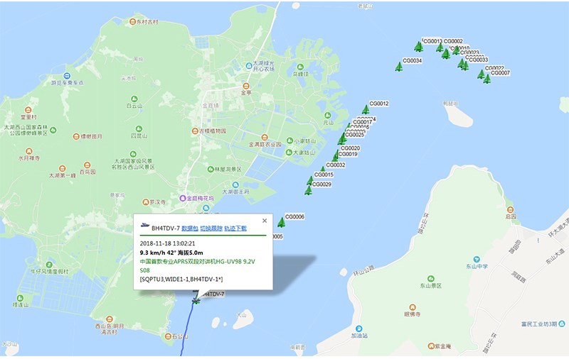
Updated 20190212C firmware version, support dynamic navigation
When the dynamic navigation function is enabled, each time a beacon for help is received, the distance and direction to the helper will be refreshed once.
, When the search and rescue team is marching, it will refresh the distance and position with the person asking for help in real time
Hiking, search and rescue, patrol, adventure, event support, helicopter aerial flight measurement and control. .
Mountain, desert, ocean, lake, aerial. . .
common problem:
Q: How far is this handstand?
Answer: Urban environment 1-3KM, open area lake 1-8KM, standing on the space station, the whole of China
Q: Can it communicate with other brands of hand or car platforms?
Answer: 1. As long as the frequency is the same, the voice can communicate in a certain range.
2.The positioning should be the same with APRS function.
Q: Is it waterproof?
Answer: It is simple and waterproof, and can not be thrown into the water.
Q: Are there any advanced waterproof machines?
Answer: Yes, prepare a purse, import YAESU 2DR and the like
Q: How much power?
Answer: 5W
Q: Which mobile APPs are supported by the UV98 handset?
Answer: Android Liuyun, Aowei, LOCUS MAP, APRSdroid, etc.
Apple, no software support, Apple Ovie can try
Q: How many hours can a single battery work in the wild?
Answer: Interval firing, 5-8 hours, depending on the intensity of trial use
Q: What is the purpose of the optional Bluetooth?
Answer: It is not necessary to plug it into the computer. It is used to wirelessly set the parameters of the UV98 console through the computer or to communicate with the computer map software.
UV98 professional APRS dual-segment positioning handstand, using standard APRS digital coding, can work independently without third-party network and third-party software support, directly send and receive positioning data to and from each other through radio U / V signals, and is widely used in outdoor sports and events Security, rescue and other occasions.
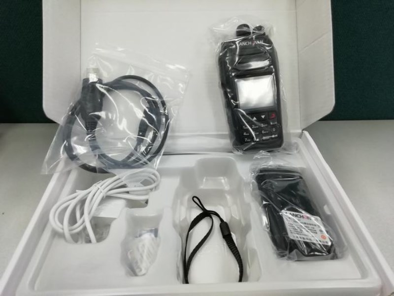
Host
Support U / V dual segment, A segment send and receive positioning data, B segment voice call.
5W, fully manual frequency setting, fast frequency adjustment
Support battery USB direct charging
Built-in auxiliary sensors such as temperature, pressure, voltage, etc.
Support user's own firmware upgrade
APRS channel
Arbitrarily set APRS channel and voice channel, A / B channel APRS, A / B channel voice
Support CH A receive CH A send, CH A receive CH B send (differential transfer), CH A receive, A send + B send
Support CH B receive CH B send, CH B receive CH A send (differential transfer), CH B receive, A send + B send
Supports off-line use, no network required, direct positioning
interface
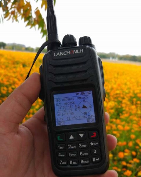
1.8-inch color display, Chinese and English menu
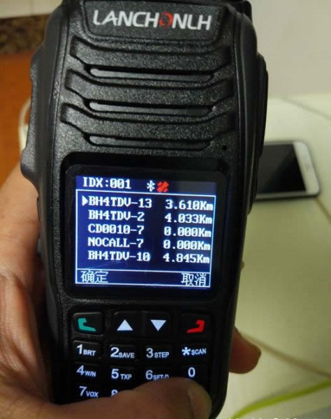
Support advanced GPS interface, beacon list interface, real-time beacon interface, beacon record analysis interface
APRS Track
Support fixed station FIXED, sport SPORT, 2 station modes
Support complete TRACK tracker, support intelligent, timing, PTT linkage, queue beacon
Support beacon additional information, mileage, number of satellites, voltage, temperature, air pressure, etc.
Support mileage calculation, support accumulated mileage or auto clear 0
Support auto icon (TRACK smart mode)
Bluetooth
Built-in latest 2.0 + 4.0 dual-mode Bluetooth, compatible with Android and Apple
Support Bluetooth output KISS hex, UI, GPWPL, KISS ASC, GS232B and other protocols
Support Bluetooth output GPS data (GPRMC + GPGGA), support mixed output
Support two-way transparent transmission of Bluetooth KISS data
Supports APPs such as Liuyun, APRSdroid, LOCUS, Aowei
Support wireless Bluetooth setting parameters
APRS relay
Support complete DIGI relay function, support custom relay name
Support relay channel A B arbitrary forwarding
Support relay remote open and close function
GPS / BeiDou
Built-in high-performance GPS BeiDou GLONASS multi-mode hybrid positioning engine
APRS Algorithm
Built-in advanced CMX hardware coding algorithm
Built-in 8-level digital level adjuster (transmitting and receiving are possible)
data analysis
Built-in large-capacity data storage, 100 beacon storage, viewing, intelligent sorting
Built-in advanced algorithm, support rich data analysis functions
Support calculation of heading, north position and relative motion
Support Maidenheide grid positioning system
Support APRS distance, horizontal angle, elevation angle and other trigonometric function calculations
Support G5500 aircraft, ship, etc.
Remotely
Support remote control of remote sensing control modules such as sensor inputs and relays
software
Supporting PC setting software (Chinese, English) (requires .NET 4.0)